
In crowdsourcing, dividing work into narrowly defined microtasks may affect the quality of the final product. Our study, published in Transactions in GIS and in collaboration with researchers from the University of Camerino, examines this problem in the context of humanitarian mapping initiatives coordinated using the Humanitarian OpenStreetMap Team Tasking Manager, analyzing 4619 projects and over 1.4 million microtasks.
Using a combination of spatial statistical techniques and expert visual inspection, we identify two main issues derived from microtask aggregation: edge-based (see example in Fig. 2) and task-wide (see example in Fig. 4) distortions .
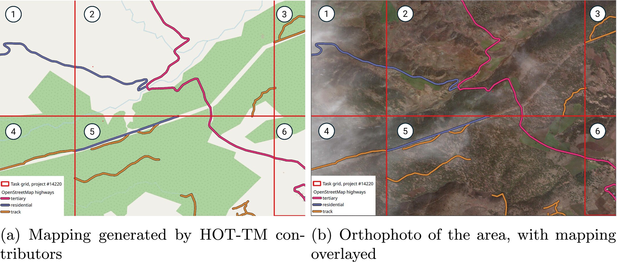
Fig. 2: Road continuation issues through task borders. In red, the HOT-TM project 14220 grid can be seen. Location: Near Tetirlik, Pazarcık, Kahramanmaraş, Türkiye. Imagery sources: © OpenStreetMap contributors; Maxar (catalogue id 1040010082B6D600) under CC BY-NC 4.0
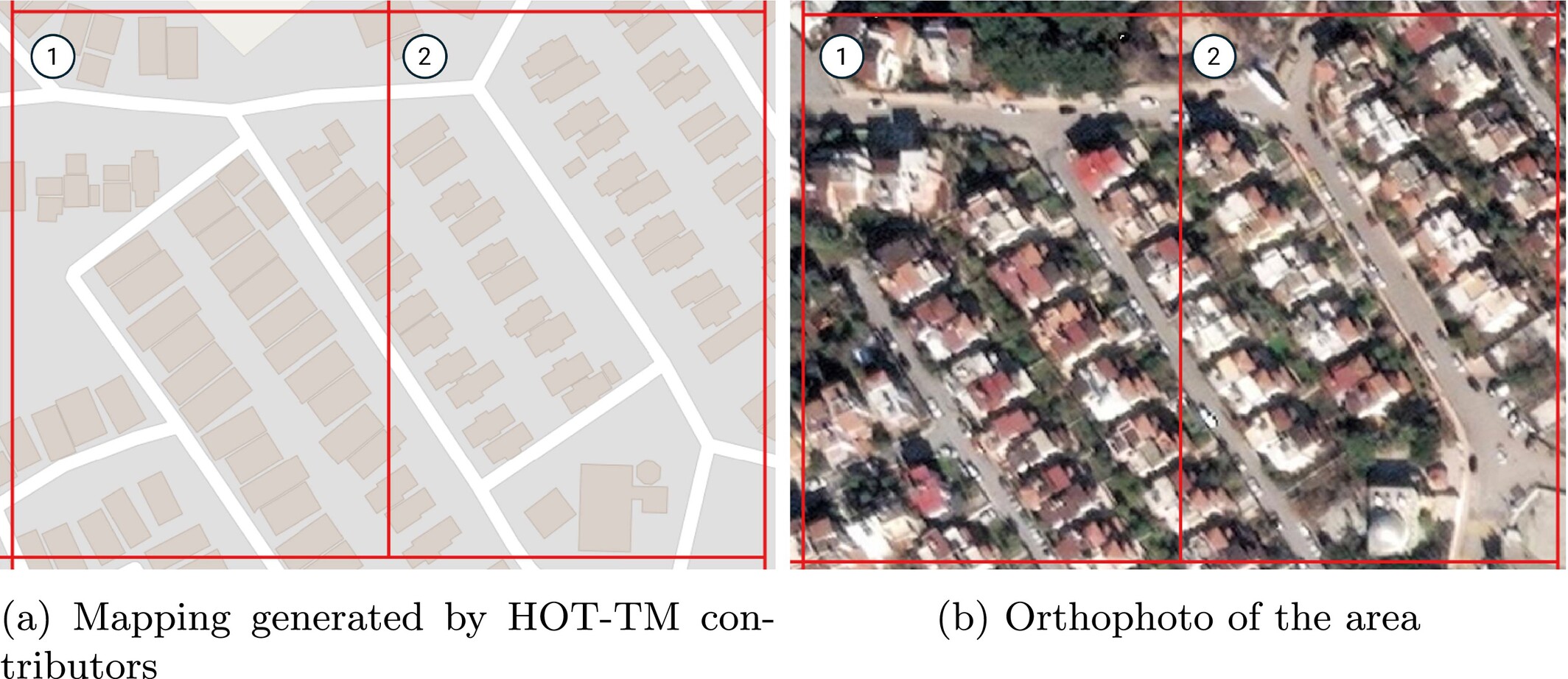
Fig. 4: Inconsistency in building mapping style. In red, the HOT-TM project 14233 grid can be seen. Location: İssume Mah., Belen, Hatay, Türkiye. Imagery sources: © OpenStreetMap contributors; Maxar (catalogue id 10300100E1B9D900) under CC BY-NC 4.0
Our findings reveal that the current microtasking model hinders the emergence of spatial collective intelligence, resulting in fragmented and inconsistent outputs that reduce the quality of the final data. Edge-based issues are identified by observing differences in event distribution between edge and interior areas. Task-wide issues are examined by computing the spatial autocorrelation of geometries within microtask areas. We propose actionable strategies to address these issues, including overlapping task boundaries and fostering implicit coordination among contributors.
Quality Issues in Crowdsourced Mapping: Microtask Aggregation in the Humanitarian OpenStreetMap Team Tasking Manager. H. OCHOA-ORTIZ, D.J. HERRERA-MURILLO, B. RE, F.J. LOPEZ-PELLICER, J. NOGUERAS-ISO. Transactions in GIS, vol. 30(3), e70288, 2026.